
EMU GIS and Cartography Beyond a Bachelor's Degree
Explore in-person graduate study in GIS and cartography at Eastern Michigan University, including certificates, master's degrees, funding, and career outcomes.

By Mason Reed
Professionals in geographic information science and cartography rarely stop learning after commencement. The field evolves quickly, with new satellite platforms, cloud geoprocessing tools, and spatial data science methods arriving every year. That constant change is why so many graduates look for advanced study that goes beyond a bachelor's degree, and why the in-person format at Eastern Michigan University remains a distinctive option for students who want depth, mentorship, and hands-on lab experience.
Eastern Michigan University has built a reputation in geospatial education that stretches back decades. Its programs combine geography, earth science, and applied technology, and the department maintains strong ties to regional employers in surveying, urban planning, environmental consulting, and government mapping. For someone weighing graduate certificates, master's degrees, or doctoral work, understanding what EMU offers in person can clarify whether the next step is worth the investment of time and tuition.
This guide examines the pathways available beyond the bachelor's degree, how the in-person experience at EMU compares with online alternatives, what careers reward advanced geospatial training, and how to pay for it. It also explains how to evaluate fit, because the right program depends on whether the goal is a promotion, a career switch, or preparation for research and teaching.
Why Advanced Study in GIS and Cartography Matters
A bachelor's degree in geographic information science or cartography gives students a foundation in map design, coordinate systems, spatial analysis, and database management. That foundation is enough for many entry-level GIS technician and analyst roles. It is often not enough for positions that involve designing enterprise GIS architectures, leading geospatial intelligence teams, teaching at the college level, or conducting original research in remote sensing and spatial statistics.
Graduate study deepens technical skill and broadens theoretical understanding. Students learn to build reproducible spatial workflows, apply machine learning to satellite imagery, model urban growth, and communicate uncertainty in maps. They also develop the research and writing habits that employers in consulting, government, and academia expect from senior staff. In a field where job titles range from GIS developer to geospatial data scientist to cartographer, the advanced credential frequently separates candidates who manage projects from those who execute them.
The Bureau of Labor Statistics projects steady demand for cartographers and photogrammetrists, with growth tied to land management, emergency response, and infrastructure planning. Many of those roles now list a master's degree as preferred, especially when they involve lidar processing, web mapping development, or geospatial database administration. For working adults considering a return to school, the question is not whether advanced study helps, but which format and program make it feasible.
What Beyond a Bachelor's Degree Means at EMU
Eastern Michigan University offers several routes for students who already hold an undergraduate degree. The most common are a graduate certificate in geographic information systems, a master's degree in geography with a GIS or cartography concentration, and interdisciplinary doctoral work through related departments. Each route serves a different purpose, and applicants should match the credential to their career goal rather than defaulting to the longest program.
A graduate certificate typically requires four to six courses and can be completed in about a year of part-time study. It suits professionals who need to add geospatial skills to an existing career, such as planners, biologists, or public health analysts. A master's degree involves roughly 30 to 36 credit hours, a thesis or capstone project, and comprehensive coursework in spatial theory, quantitative methods, and cartographic design. Doctoral study prepares students for research careers, university teaching, and senior roles in agencies that develop geospatial standards.
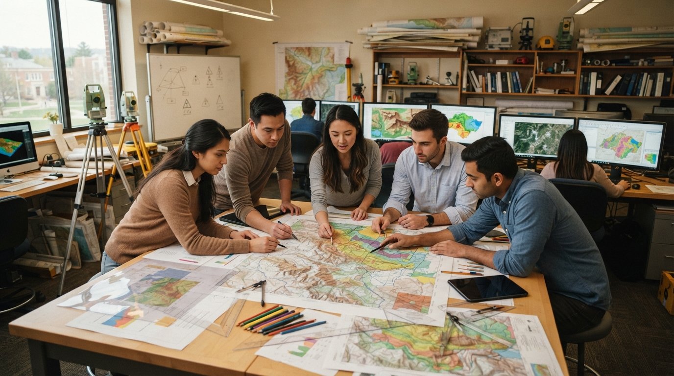
Because EMU delivers these programs in person, students gain access to specialized equipment and face-to-face instruction that online programs struggle to replicate. That includes GIS laboratories with current software licenses, GPS and surveying instruments, drone platforms, and large-format printing for cartographic production. In-person cohorts also build professional networks through seminars, guest lectures, and internships with nearby organizations.
The In-Person Advantage at Eastern Michigan University
Online GIS degrees have expanded access to geospatial education, and they work well for self-directed learners who already have professional experience. In-person study offers something different: immediate feedback, spontaneous collaboration, and immersion in a campus culture of inquiry. At EMU, students in the geography and geology department work alongside faculty who conduct research in areas such as watershed analysis, urban sustainability, and geospatial education.
Laboratory courses are a central part of the in-person experience. Students learn to calibrate instruments, troubleshoot software, and interpret results in real time with an instructor nearby. Group projects simulate the consulting environment, where a team must divide tasks, meet deadlines, and present findings to a client. Those experiences translate directly into job interviews, because employers want evidence of teamwork and problem solving, not just a transcript.
In-person study also makes it easier to pursue funding through assistantships. Graduate assistants at EMU often support faculty research, manage lab equipment, or help teach undergraduate courses. These positions reduce tuition costs and provide professional experience that strengthens a resume. Students who need flexibility can sometimes combine in-person core courses with a limited number of online electives, but the heart of the program remains on campus.
For those weighing this option against other institutions, it helps to compare regional programs carefully. A guide to geology and earth science study at Amherst College illustrates how different departments structure their earth science curricula, which can inform questions about faculty expertise and lab resources when visiting EMU.
Program Options and Curriculum Depth
At the graduate level, coursework at EMU moves beyond introductory mapping into advanced spatial analysis, geodatabase design, remote sensing, and cartographic visualization. Students commonly take classes in geographic information systems, spatial statistics, aerial photography and image interpretation, and web mapping. Electives may cover environmental modeling, transportation geography, or community planning, depending on faculty availability and student interest.
The master's program usually requires a research component. Students may choose a thesis track for academic or research careers, or a capstone track for professional practice. The thesis involves original data collection and analysis under a committee's guidance, while the capstone applies geospatial methods to a real-world problem for a partner organization. Both options culminate in a public presentation, which builds the communication skills that cartographers and GIS managers use daily.
Graduate certificates offer a shorter path. A typical sequence includes courses in GIS principles, spatial data management, and cartographic design, with an elective in remote sensing or programming. Certificate holders can often apply those credits toward a master's degree later if they decide to continue. This stacking approach lets professionals test the waters before committing to a full graduate program.
Doctoral students in related fields, such as environmental science or urban studies, may incorporate geospatial methods into their dissertations. EMU faculty with expertise in GIS and cartography can serve on dissertation committees, giving doctoral candidates access to specialized guidance even when their home department is interdisciplinary.
Admission Requirements and Application Steps
Admission to graduate study at EMU is competitive but accessible to motivated applicants from a range of backgrounds. Requirements vary by program, so prospective students should confirm details with the department before applying. In general, applicants submit transcripts, a statement of purpose, letters of recommendation, and sometimes GRE scores, though many programs have relaxed testing requirements in recent years.
A strong application shows that the applicant understands the field and has a clear reason for pursuing advanced study. That might mean describing a current job that requires GIS skills, a research question developed during undergraduate work, or a career change into geospatial technology. Letters of recommendation should come from instructors or supervisors who can speak to analytical ability and work ethic.
The application process typically follows a sequence:
- Identify the specific program and credential (certificate, master's, or doctoral) that matches your goal.
- Review prerequisites, such as undergraduate coursework in geography, statistics, or computer science.
- Prepare application materials, including transcripts, statement of purpose, and recommendations.
- Submit the application by the posted deadline and complete any required interviews or placement exams.
- Apply for financial aid, assistantships, and scholarships once admitted.
Deadlines for fall admission often fall in the preceding winter or spring, while spring and summer starts may have rolling deadlines. International applicants should allow extra time for credential evaluation and visa processing. Veterans and active-duty service members can often use GI Bill benefits, and the university has staff who help certify enrollment.
Career Outcomes for Advanced GIS and Cartography Graduates
Graduates with advanced geospatial training move into roles across the public and private sectors. Common employers include city and county planning departments, state environmental agencies, federal mapping and intelligence organizations, engineering and surveying firms, utility companies, and nonprofits focused on conservation or community development. Job titles include GIS analyst, geospatial data scientist, cartographer, remote sensing specialist, and GIS manager.
Salaries vary by region and sector, but advanced credentials generally command a premium. According to national labor data, cartographers and photogrammetrists earn a median annual wage in the mid-$70,000s, with experienced professionals in management or specialized technical roles earning six figures. GIS analysts in government often start lower but receive strong benefits and retirement packages. Private consulting can pay more, though workloads fluctuate with project cycles.
A master's degree also opens doors to leadership. GIS managers oversee budgets, staff, and enterprise systems, and they need the strategic perspective that graduate coursework provides. Research and teaching positions at community colleges typically require at least a master's degree, while four-year universities and research institutions expect a doctorate. For students who enjoy mentoring and discovery, the academic path can be deeply rewarding.
Career changers should consider how quickly they need to enter the workforce. A graduate certificate can be completed in a year and may be enough to qualify for technician or analyst roles. A master's degree takes longer but offers higher ceilings and more specialization. Working adults can often continue employment while studying part time, applying new skills on the job as they learn them.
Funding Your Graduate Education
Graduate study is an investment, and financial planning should begin before applications are submitted. Funding sources include federal loans, university scholarships, graduate assistantships, employer tuition benefits, and external grants. Veterans may qualify for the Post-9/11 GI Bill, which covers tuition and provides a housing allowance. Some states offer loan repayment programs for graduates who work in public service or underserved areas.
Assistantships are particularly valuable because they reduce or eliminate tuition and provide a stipend in exchange for teaching or research duties. At EMU, graduate assistants in geography and related departments may help run labs, grade assignments, or support faculty projects. These positions are competitive, so applicants should express interest early and highlight relevant skills such as programming, technical writing, or prior teaching experience.
Employer tuition assistance is another underused resource. Many companies and agencies reimburse part or all of the cost of job-related coursework. Employees should check their human resources policies and, if necessary, make a business case for how geospatial training will improve their performance. Even partial reimbursement can make a master's degree affordable over several years of part-time study.
Prospective students who want to compare costs and program formats across institutions can explore accredited degree options for working adults as a starting point for research. That kind of comparison helps families understand the range of price points and delivery models before committing to a single school.
Is In-Person Graduate Study Right for You?
The decision to pursue graduate study beyond a bachelor's degree depends on personal circumstances, career goals, and learning style. In-person programs at EMU suit students who value structure, direct mentorship, and access to specialized equipment. They also suit those who plan to work in the region and want to build local professional networks during their studies.
Online programs may be a better fit for students who cannot relocate, who travel frequently for work, or who prefer to learn at their own pace. Hybrid options can bridge the two, combining the flexibility of online coursework with periodic campus visits for labs and seminars. The key is to choose a format that matches how you actually learn and live, not the format that sounds most convenient.
Prospective students should visit campus, meet faculty, and talk with current graduate students before deciding. Ask about class sizes, lab access, assistantship availability, and job placement rates. Those conversations reveal more than a website can, and they help applicants write stronger statements of purpose. A program that feels like a good fit is easier to finish and more likely to pay off.
Advanced study in geographic information science and cartography is not merely an extension of undergraduate work. It is a transition into professional mastery, where technical skill meets critical thinking and communication. For students willing to invest the time, Eastern Michigan University's in-person graduate pathways offer a rigorous and supportive environment to make that transition. With careful planning, the degree can lead to leadership roles, research opportunities, and a lasting career in a field that maps the world.